Translate

giovedì 28 marzo 2024

139.I MIEI 34 LIBRI DI VIAGGI, AVVENTURA E ANTROPOLOGIA SUDDIVISI PER ARGOMENTO E AREE GEOGRAFICHE


(© Franco Pelliccioni)


(174 pp., 258 note, 173 foto)
Le copertine delle quattro versioni del mio ultimo libro
E-Book € 9,99:  https://www.amazon.it/dp/B0CP2Z7QT3

versione cartacea a colori "premium": €  34,99
https://www.amazon.it/dp/B0CPSNZ9BW

versione cartacea in bianco e nero 
€ 22,99 : https://www.amazon.it/dp/B0CPVC5QBM

versione cartacea non illustrata 11https://www.amazon.it/dp/B0CQ7FTRZX


    ANTROPOLOGIA

E-Books
 9,99 (da Adolf Bastian a Vinigi Grottanelli)  https://www.amazon.it/dp/B07GKR6BKP

 9,99 (da Thor Heyerdahl ad Alfred Reginald Radcliffe-Brown) https://www.amazon.it/dp/B07J5J84J2

9,99  (da Knud Rasmussen a Rosebud Yellow Robe) https://www.amazon.it/dp/B07L5PFFF1

Versione cartacea in bianco e nero:  18,55 (171 pp, 145 foto)  https://www.amazon.it/dp/1719852340

 20,68 (181 pp, 163 foto) https://www.amazon.it/dp/1728759420

 20,72 (188 pp, 157 foto) https://www.amazon.it/dp/1790972345

ARTICO E SUBARTICO 

E-Book:
20,99 https://www.amazon.it/dp/B01H35AOGE

Versione cartacea a colori, I ediz.
46,45 https://www.amazon.it/dp/1520604041

Versione in bianco e nero I ediz.
21,09 https://www.amazon.it/dp/152075048X

Versione cartacea a colori II ediz. :57,42 (243 pp., 232 foto) https://www.amazon.it/dp/1790164621

Bianco e nero 22,05 : https://www.amazon.it/dp/1790246121

                                                      ISLANDA

 E-Book 17,99https://www.amazon.it/dp/B01I7623LW 
Versione cartacea a colori,
I ediz.40,84 : https://www.amazon.it/dp/152068589
Versione cartacea bianco e nero,
I ediz21,46  https://www.amazon.it/dp/1520757409

                            Versione cartacea a colori, II                                                    ediz.70,48 (299 pp., 345 foto)
                     https://www.amazon.it/dp/1790378923
Versione cartacea bianco e nero, II ediz.23,65https://www.amazon.it/dp/1790468795
  
PASSAGGIO A NORD-OVEST

E-Book 15,99https://www.amazon.it/dp/B09X5DW3HK
Versione cartacea a colori: 
43,10 (268 pp, 174 note, 254 foto) https://www.amazon.it/dp/B09ZB7794T
Versione cartacea bianco e nero 28,95https://www.amazon.it/dp/B09ZCS95LJ

AVVENTURA 

E-Book 12,99https://www.amazon.it/dp/B07732SMT8

Versione cartacea in bianco e nero I ediz. 20,52 (157 pp, 115 foto):https://www.amazon.it/dp/197322934X

II ediz. 20,53 : https://www.amazon.it/dp/1729158544


RAIDS AUTOMOBILISTICI: PECHINO PARIGI E CITROEN

E-Book 9,86https://www.amazon.it/dp/B01LXYSS4A 

Versione cartacea in bianco e nero 15 Euro (109 pp, 104 foto)https://www.amazon.it/dp/B09LGRPW17

    BALENE E CACCIA ALLE BALENE


Versione cartacea a colori 31,39 (163 pp, 156 foto)https://www.amazon.it/dp/B0C522JP54

e in bianco e nero 20,56https://www.amazon.it/dp/B0C52BPD2B
 

 CITTA' MONDIALI 

                                   DUBLINO


Versione cartacea a colori 
I ediz21,79 (116 pp., 104 foto): https://www.amazon.it/dp/1520911823

Versione cartacea a colori 


PARIGI ESPOSIZIONI UNIVERSALI


Versione cartacea a colori Euro 35,29 (118 pp, 146 foto) https://www.amazon.it/dp/1071353543


LISBONA
E-Book 16,99 https://www.amazon.it/dp/B08R6CZGR6

Versione cartacea a colori 41,64 (243 pp., 288 foto)https://www.amazon.it/dp/B08RRKNH4V

Bianco e nero 26,86https://www.amazon.it/dp/B08RRJ8ZZY

LISBONA EDIZ. NON ILLUSTRATA

E-Book €8,80https://www.amazon.it/dp/B08MZ4592N

Versione cartacea € 15,33 (118 pp.)https://www.amazon.it/dp/B08N37JBWT

  ESPLORAZIONI

 
E-Books: 
14,99 (Europa-Asia) https://www.amazon.it/dp/B07MGDKQKD

15,99 (Africa)   https://www.amazon.it/dp/B07T8TLLTV

9,99 (Artico-Antartico) https://www.amazon.it/dp/B081FD5HWH

15,99 (America)  https://www.amazon.it/dp/B0837Y4DWD


Versioni cartacee in bianco e nero:
20,84 (188 pp., 157 foto) https://www.amazon.it/dp/1794173943

26,73 ( 224 pp., 179 foto) https://www.amazon.it/dp/1076149073

20,36 (134 pp., 116 foto)  https://www.amazon.it/dp/1708675663

26,93 (219 pp., 166 foto)  https://www.amazon.it/dp/1653579420

 "GIRO DEL MONDO"

E-Book € 16,99 : https://www.amazon.it/dp/B07XPFQGLW

Versione cartacea a colori 
€ 53,14  (241 pp., 223 foto)https://www.amazon.it/dp/1692957171

Bianco e nero 
€ 25,89:  https://www.amazon.it/dp/1693164949

  GRANDI VIAGGI

                COLOMBIA BRITANNICA E ALASKA


E-Book € 14,99 : https://www.amazon.it/dp/B09KQTVDZD

Versione cartacea a colori 

: 35,34 (192 pp., 191 foto)  https://www.amazon.it/dp/B09L4SBWHQ

Bianco e nero € 23,64 https://www.amazon.it/dp/B09L4NZDB2


ISOLE E ARCIPELAGHI TRA ATLANTICO E                            MEDITERRANEO
ST KILDA, ATLANTICO SETT.

E-Book € 9,99 : https://www.amazon.it/dp/B01N8R37RZ

Versione cartacea a colori  I ediz. 

€ 21,49 (101 pp, 68 foto)  https://www.amazon.it/dp/1520343477

II ediz. € 23,66: https://www.amazon.it/dp/1791748090


ISOLE SHETLAND
E-Book € 9,99 : https://www.amazon.it/dp/B07N53RZCH

Versione cartacea a colori 
€ 35,59 (133 pp., 114 foto) https://www.amazon.it/dp/1793119147

Bianco e nero € 20,36https://www.amazon.it/dp/1094761575

                              SHETLAND IN ENGLISH
E-Book £ 9,99 https://www.amazon.co.uk/dp/B07PJCFJL2

Colour £ 31,10 (131 pages, 115 photos) https://www.amazon.co.uk/dp/1799117596

B/W £: 20,34 https://www.amazon.co.uk/dp/1094776688
       ISOLE ORCADI    

E.Book € 9,99 https://www.amazon.it/dp/B084D7YKBD

Versione cartacea a colori 
€ 44,18 (178 pp., 172 foto)   https://www.amazon.it/dp/B084DG2X5L

Bianco e nero 
€ 22,58https://www.amazon.it/dp/B084DH6B2
5

ISOLE FAROER

E.Book€ 9,99https://www.amazon.it/dp/B093Q4KRSL

Versione cartacea a colori € 35,0(182 pp., 180 foto) : https://www.amazon.it/dp/B0942FDTP5

Bianco e nero € 22,51https://www.amazon.it/dp/B0948JWTX2
FAROER AND CARNIA IN EGLISH

E-Book $ 9,99 : https://www.amazon.com/dp/B07217YHJ8

Color paper version I edit. $ 23,21 (111 pages, 105 photos):  https://www.amazon.com/dp/1521472084 

Color paper version II edit. $ 37,01 : https://www.amazon.com/dp/1731551932

Black and white paper version  

$ 21,75 https://www.amazon.com/dp/1095009621


                                             ISOLA DI CRETA

E-Book € 9,99  https://www.amazon.it/dp/B07HZ2JWTS

Colore, I Ediz€ 27,34 (153 pp., 179 foto) https://www.amazon.it/dp/1728915961

Colore II ediz€ 43,22  https://www.amazon.it/dp/1093729066

Bianco e nero € 15,68 https://www.amazon.it/dp/1729033830


    GRANDI NAVIGATORI 
E-Books: 
 € 14,99 (XIV-XVIII secolo) https://www.amazon.it/dp/B077LVJGGJ

€ 15,99 
(XIX secolo) https://www.amazon.it/dp/B079ZMVGQL

€ 9,99 (XX secolo)https://www.amazon.it/dp/B07BPWZLTP


Versioni cartacee a colori I ediz.: 
 € 33,79 (170 pp, 130 foto):https://www.amazon.it/dp/1973354330

33,69 (165 pp., 150 foto)https://www.amazon.it/dp/1980379076

22,60 ( 113 pp., 104 foto) https://www.amazon.it/dp/1980788987

Bianco e nero I ediz. :
21,42https://www.amazon.it/dp/1973386313
 
22,39https://www.amazon.it/dp/1980405522
 
16,03https://www.amazon.it/dp/1980798788

Colori II ediz.


Bianco e nero II ediz.


    PAESI NON SOLO ESOTICI

                                              TUNISIA

E-Book € 15,99:  https://www.amazon.it/dp/B07DMR385M

Versione cartacea a colori  I ediz€ 35,95 (178 pp., 198 foto): https://www.amazon.it/dp/198314018X

Bianco e nero I ediz
€ 23,48https://www.amazon.it/dp/198316870X

Versioni cartacee II ediz.
Colori € 54,10:  https://www.amazon.it/dp/1093834021

Bianco e nero € 24,87https://www.amazon.it/dp/1093941766
EGITTO

E-Book € 16,99https://www.amazon.it/dp/B088HHLKGM

Versione cartacea a colori 
€ 66,01 (238 pp., 271 foto):  https://www.amazon.it/dp/B088N3WVYN

Bianco e nero 
€ 28,17https://www.amazon.it/dp/B088N8ZQVV

Ediz. non illustrata
E-Book € 8,99https://www.amazon.it/dp/B08BXQCMRY

Versione cartacea 
17,17 (133 pp.)https://www.amazon.it/dp/B08BW8LYDY

EGITTO FOTOGRAFICO, EGYPT PHOTO-BOOK, 
ITALIANO-ENGLISH

E-Book € 15,99 : https://www.amazon.it/dp/B08DCZ7D9F

$ 18,27: https://www.amazon.com/dp/B08DCZ7D9F

 Versione cartacea a colori 
€ 33,81(171 pp., 278 foto, di cui 277 a colori) https://www.amazon.it/dp/B08DGCFSDH

Color paper version $ 33,67  : https://www.amazon.com/dp/B08DGCFSDH

E-Book € 9,86 : https://www.amazon.it/dp/B01N2WVOAY

Versione cartacea a colori I ediz.
€ 20,86 (116 pp., 76 foto): https://www.amazon.it/dp/1520223471

Colori II ediz .€ 36,06 :https://www.amazon.it/dp/1729067956

Bianco e nero € 21,20https://www.amazon.it/dp/1094812188


E-Book € 9,86https://www.amazon.it/dp/B01N3BOKBP 

Versione cartacea in bianco e nero € 15,05 (108 pp., 47 foto)https://www.amazon.it/dp/1520532458


giovedì 21 marzo 2024

138. ULTIMA THULE. MEMORIES OF A WINTER STUDY JOURNEY TO THE SHETLAND ISLANDS [SCOTLAND, UK]


E-Book, paper version in colour and black and white, 131 pages, 119 notes, 115 images, of which 90 in colour (55 belong to the Photo Gallery of the A.) 
E-Book: https://www.amazon.co.uk/dp/B07PJCFJL2

Colour https://www.amazon.co.uk/dp/1799117596

B/W: https://www.amazon.co.uk/dp/1094776688


Pytheas "had heard that it is the most northerly of the British Isles, six days to the north of Britain and close almost one day only from the "Sea Ice", if it was not conceived as "Congealed Sea" (...) in which land and sea and everything floats, which is in a kind of jumble that holds all these things together, something that cannot be exceeded by men and ships (...) there is habitable land up to the "extreme parts around Thule".

   Pytheas is the Greek geographer, navigator and astronomer of Marseilles (then Massilia) who, at the end of the fourth century B.C., made his famous and adventurous journey to the European boreal lands. Up to what was defined as the island of Thule or Ultima Thule: "extreme inhabited and habitable region, beyond which it was the domain of the sea, the fog, the storms and the ice". According to some, Thule would be identifiable in the Shetland Islands. According to others, it could be Norway, or even Iceland. The great Ptolemy in his Geography of 150 A.D. is in favour of the Shetland Islands3, north of Scotland "and on the mainland of Eurasia, near the same latitude, the Hyperborean Mountains, from which the Volga (Rha) springs flow".

   I do not know if this northern archipelago is the Thule, more or less "Ultima", of the adventurous Greek. Undoubtedly for me, the island of Mainland represented the northernmost point touched in my life. Especially since the particular geo-astronomical aspect was immediately confirmed, if it was still needed, by the harsh winter climate. Connected by a frost so intense as to penetrate the bones. Often accompanied by impressive gusts of wind, suddenly able to push you. A worrying thing, indeed, especially when I went to admire the beautiful and impressive cliffs of the island overhanging the sea. So much to compel me, precautionary, to observe them from the edge, staying carefully "belly on the ground"...

   And to say that, the year after, not even nine months away, I would even have reached the closest point to the Magnetic Pole. In Resolute Bay (Lat 74 ° 41 'N), in the Canadian High Arctic, during my anthropological survey among the Eskimos (Inuit). Then, twenty years later, on two occasions, in the Norwegian Arctic Islands of Svalbard, I would have crossed that latitude. First in Longyearbyen (Lat 78 ° 13' N), the capital, afterwards in Ny-Ålesund (Lat 78 ° 55' N), the historic "King’s Bay", on the occasion of the inauguration of the Italian Station Airship Italia.

   Yet in 1982 I could feel more than satisfied with what, at the time, was my personal record. For the first time in my life I, who had carried out fieldworks only in tropical countries, could even think of finding myself more far north, than I really was. Like the numerous protagonists of the adventurous exploring and ethno-anthropological expeditions, that fascinated me so much as a boy.

   The idea of writing this book, making it available to a wider audience of readers, compared to those who had been able to read my articles on the subject, published in magazines and newspapers, came watching some episodes of: Shetland, a television series, produced by ITV for BBC Scotland. The protagonist was a police detective from Lerwick who, of course, successfully investigated the murders perpetrated in Mainland, the main island of the archipelago. Among other things, originally he was from Fair Island, the southernmost island, halfway between Shetland and Orkney.

   Unexpectedly I felt a strong sense of nostalgia, looking again on the screen that environment, so completely different from the Mediterranean. Almost always characterized by a chiaroscuro of unusual, albeit singular, beauty. Which, soon left aside, after a strong shower of rain. Leaving space to vivid colours, which paradoxically make their appearance, one by one. The majestic panoramas, the gigantic cliffs overlooking the sea, the low clouds, the decidedly subarctic atmosphere, reminded me that those islands could really represent, about 2,500 years ago, the last habitable land of the oecumene. Because, even at a not so excessive latitude, I could even have the good luck to admire, high in the night sky, the shattering and phantasmagorical Northern Lights of the Ultima Thule...

   That Nordic journey, carried out above all in a prohibitive season (December), would have been for me the very first approach to an ecological-cultural reality, radically different from all those that, until then, I knew (Sudan, Kenya, Mexico). That, the following year, with my survey among six Inuit communities of the Canadian Arctic, it would be strengthened. Since, in the mythical North West Passage, I would have gone even further north, not too far from the Magnetic Pole. As I have already mentioned...

   Among other things, in those Scottish islands the former Africanist, as I was, would "meet" the Vikings for the first time. An initial approach, which later should have been consolidated. Since the Shetlands unknowingly represented the first of many "steps" of my future wandering, on the trail of the so-called Viking “Overseas Movement”, which would lead me: still to the South-West (Orkney, Scotland and North-Eastern England, Outer Hebrides, Fær Øer, Dublin), to the North (Svalbard), to the West (Newfoundland, Iceland, Greenland, Labrador), to the South (Normandy), to the East (Russia).

   From the foundational point of view of the Maritime Communities, that later I would approach, the "Vikings" constituted only one of the different aspects, present in the whole picture, even if among the most important and adventurous. Thanks to that study trip or, if you like, reconnaissance, before to the Shetlands, then to the southern Orkneys, even if unintentionally would have been thrown the first seed of what later would be transformed into my North Atlantic Maritime Community Program.

   Communities that, even if spatially very distant from each other, have many common features. In fact, in addition to the presence of the Scandinavian raiders, who later became peaceful settlers, when we talk about North Atlantic Islands, we cannot fail to mention their geo-cultural isolation, sometimes even linguistic (for example: Fær Øer and Iceland). Again, from the glottological point of view, the islands can be "dichotomized", because it is possible to distinguish those of substantially Celtic-Gaelic derivation, from those of originally Scandinavian-Viking language and culture. Furthermore, their distance from the mother country must be underlined. So, the difficulty, or the total absence, of the maritime connections, especially in a more or less distant past. This often was added to the shortage or lack of essential supplies, especially food (in winter, but also in case of repeated and negative weather conditions). Capable of provoking recurrent collective existential crises. Enough to make even impossible to survive. So that, as extrema ratio, repeatedly they would resort to the evacuation of their inhabitants. As in the case of the Outer Hebrides (island of Mingulay), or of the far more remote island of the "bird-men" of St Kilda. Otherwise, it was thought seriously to clear all the islanders (Iceland).

   Based on the universe around, both terrestrial and marine, over time communities have sought to diversify their economies. So, even in consideration of the difficult conditions of the ocean waters, the islanders have often preferred to devote themselves to the hard cultivation of small plots of land (crofts), to obtain the necessary to survive. Rather than engaging in fishing. Which, when it happened, generally was only coastal, and faced with modest boats. Fact also due to the almost total lack of trees, which went hand in hand with the gradual loss, over time, of the indispensable nautical know-how. In fact, this was an insurmountable deterrent, which in most cases would have prevented them from going on to build vessels able to sail the ocean.

   Thus, from the historical-cultural point of view, the Shetland islanders have been defined as "peasants with a boats". Compared to their Orkney "neighbours", considered "fishermen who cultivate". Cultivations in both cases associated with sheep breeding, both for wool and for meat. To which in several archipelagos fowling is added, for the presence of innumerable sea birds, which nest in the islands, for meat and eggs. As well as for the feathers, essential for cushions and mattresses padding, etc. In the years, the Shetland communities have gone through genuine "Cultural Revolutions": four, from the middle of the nineteenth century to today! The penultimate of which, induced by the discovery and exploitation of oil in the North Sea, with the drilling platforms, saw me in 1982 as a witness.

   I have dedicated the main chapters to the archipelago as a whole, to Mainland, the largest of the islands, and to the capital Lerwick. I added another chapter on Fair Isle, which I only observed flying over it with the plane, which took me to Orkneys. Since it is an important island. Not just because the model of the famous Shetland pullover comes from there. But for the reason that it was the scene of an innumerable series of shipwrecks, both of foreign ships, such as El Gran Grifón, belonging to the Spanish Great Armada, and of many island boats, in the so-called Year of the Disaster

Engraving by Jules Noël, 1873, representing the shipwrecks of the Invincible Armada in 1588

   Naturally I have integrated and updated the statistical, economic and demographic data included in the volume. In order to offer the reader a picture, as complete as possible, of the "situation" of the archipelago, as it appears at the end of 2018.

   I also dedicated a chapter to Durham, where I made a "stopover", before continuing the journey to the islands. A city in the north of England, that shares many aspects of its history, both with the Viking World, and with the same Shetland.

SUMMARY
PREFACE 

INTRODUCTION 

STOPOVER IN THE NORTH OF ENGLAND: DURHAM AND THE EXCURSION TO THE LAKE DISTRICT 
Durham, "model" of Urban Geography 
Warkworth, Lindisfarne and Durham 
Durham Foundation 
Sir Walter Scott, the Shetlands and Durham 
From coal mines to university colleges 
The excursion to Lake District 

HISTORY OF SHETLANDS 
The Picts, the Brochs, Jarlshof 
Jarlshof 
Broch Clickhmin, Lerwick 
Vikings, Norwegians, Danish-Norwegians, Scots 
The archipelagos of the Shetlands and Orkneys offered under warranty to Scotland 

LANGUAGE, BETWEEN ENGLISH AND NORN 
Folklore 
The Up-Helly-Aa 

LINKS WITH NORWAY 

ECONOMY 
Agriculture 
Breeding 
Fishing and fish farming 
Oil 
Tourism 

BIRTH (WITH ORIGINAL SIN) AND DEVELOPMENT OF LERWICK 
Some significant urban development dates 
The "original sin" of Lerwick: smuggling 
The history of lodberries 

MAINLAND 
Lerwick 
Scalloway 
In the north of Mainland: The Gallows Hill (The "Hill of Witches"), Tingwall, Weisdale Voe, Esha Ness 
In the south of Mainland 

COLLECTIVE EXISTENTIAL CRISIS 

FOUR CULTURAL REVOLUTIONS 
First Revolution, 1886: The Crofters' Act 
Second Revolution, 1960: wool, knitwear, refrigerated fish, silver craftsmanship 
Third Revolution, 1971-1998: discovery and exploitation of oil and gas 
Fourth Revolution, 1998-today: contraction of oil extraction, revival and development of traditional economic activities (crofting, breeding, fishing, fish farming), tourism 
Oil, gas 
Fishing and fish farming 
Cultivation, breeding, tourism 

SMUGGLING AND PIRACY IN THE ARCHIPELAGO 

SHIPWRECKS 
In Scotland
Protection of wrecks of historical importance 
In the Shetlands 
The ground stations of the haaf: Walls and Stenness (Mainland) 
"Important" shipwrecks and wrecks protected by law: XVII-XVIII century 
During the Great War 
In the Second World War 

FAIR ISLE 
1. The shipwreck of El Gran Grifón, 1588 
2. Shipwrecks, 1868-1894 
3. The “Year of the Disaster”, 1897 
The background 
The tragedy begins 
The request for help 

ESSENTIAL BIBLIOGRAPHY


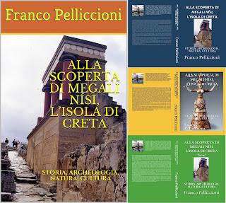
137. ALLA SCOPERTA DI MEGALI NÍSI, L’ISOLA DI CRETA. STORIA, ARCHEOLOGIA, NATURA, CULTURA


E-Book, versione cartacea a colori - I e II ediz. - e in bianco e nero, 153 pp., 179 foto, di cui 148 a colori (128 sono dell’A.)

E-Book https://www.amazon.it/dp/B07HZ2JWTS

Colore, I Ediz. https://www.amazon.it/dp/1728915961

Colore II ediz. https://www.amazon.it/dp/1093729066


Nonostante le carte la facciano sembrare distantissima, non è poi così difficile arrivare dall'Italia all'isola di Creta. Qualche difficoltà invece la si può incontrare allorché ci si sposta al suo interno. Nonostante la presenza sulla costa settentrionale di una strada, eufemisticamente definita “autostrada” (ha diversi tratti a doppia corsia) grazie alla quale abbastanza facilmente si può andare da Ágios Nikólaus (ad est) fino ad Haniá nell'ovest, passando per il capoluogo Herákleion e Réthimno...

   A bordo dell’aereo di linea delle Aegean Airlines, che in soli cinquanta minuti di volo mi stava portando da Atene ad Herákleion, le condizioni viarie dell'isola non erano certamente comprese nei miei pensieri. Come più volte era capitato nel corso dei miei viaggi di avvicinamento, mi stavo invece domandando cosa ci si poteva aspettare dalla quinta più grande isola del Mediterraneo, con una superficie di poco inferiore a quella della Corsica. Sapevo come fosse l’isola del Mito per antonomasia. Vi era nato Zeus e a Cnosso si trovava il labirinto del Minotauro fatto costruire da Minosse. Creta era quindi la patria del mito dei miti...  Per gli archeologi l'isola è in effetti un autentico Eldorado. Non solo perché la cultura minoica del bronzo, ampiamente presente con i suoi grandiosi e stupendi Palazzi, ha preceduto per splendore quella greca classica. Accanto alle aree archeologiche universalmente note, come Cnosso, Festo, Mália, il suo territorio è costellato, infatti, da decine e decine di centri minoici grandi e piccoli: città palaziali, insediamenti, ville, grotte cultuali, santuari, necropoli, abitati-rifugi protogeometrici. Oltre a città arcaiche, romane e proto-bizantine...

 Creta è certamente immensa. Se per i greci è Megali Nísi, la "grande isola", per i cretesi è addirittura un continente. In effetti anche al viaggiatore appare ben più grande di quanto sia in realtà. Poiché nell'arco di pochi chilometri: appena al di là di una montagna, di una baia, di un promontorio, vi si ritrovano i più diversi ecosistemi e paesaggi. Curiosamente le distanze tendono ad "allungarsi" anche per la presenza di una serie di aspre montagne, che dividono il nord dal sud e che si superano solo grazie ad alcune tortuosissime valli latitudinali.

   Contribuiscono a rafforzare l'immagine di una grande Creta anche le tuttora difficili condizioni viarie generali. Tanto che più volte sono andato con il pensiero a certe strade percorse in Africa orientale. Mentre gli "esagerati" andamenti e le pendenze delle strade di montagna mi hanno invece ricordato quelle islandesi, anche per la presenza di forti raffiche di vento... L'estrema pericolosità delle strade (per le loro condizioni e per la guida "disinvolta" della maggior parte dei conducenti locali) è testimoniata in ogni angolo dell'isola dalla presenza di cappellette "in memoriam". So bene, inoltre, come esistano numerose piste utilizzabili solo dai fuoristrada e come alcuni insediamenti nel sud siano raggiungibili esclusivamente per via mare.

   D'altronde fino agli anni '1970 riusciva assai difficoltoso inoltrarsi nelle montuose regioni centrali. L'intero percorso andava affrontato a piedi o a dorso di mulo. Oggi le difficoltà non sono scomparse del tutto. Ad esempio l'itinerario che si deve obbligatoriamente seguire per giungere nel sud a Frangokástelo, attraversando l'impervia regione di Sfakiá, da altri definito come "uno dei più eccitanti viaggi automobilistici di Creta", è una serpeggiante successione di arrampicate, discese e curve a gomito, che si affrontano confidando che gli autoveicoli in senso contrario non si discostino troppo dal loro lato...

   L'isola è caratterizzata da un clima mite tutto l'anno, ma anche da una nutrita presenza di venti, secondo la stagione e la provenienza. In primavera, alzando turbini di polvere, arriva dal Nord Africa e dalla Libia il subdolo sorokos, tanto temuto dai vecchi pescatori che, tradizionalmente, si andavano subito a rifugiare nei porti. D'estate per una quarantina di giorni soffia da nord ovest il fresco meltemia, assai bene accetto, perché rende sopportabili le temperature tropicali del periodo. Da ovest c'è poi il garbis, mentre il boreas soffia all'inizio dell'inverno.

   La posizione geo-culturale di Creta tra tre continenti (Africa, Asia ed Europa) nel bene e nel male ha influito fortemente sulla sua storia, che più complessa di così non poteva essere... Fin dai tempi più antichi l'isola ha infatti conosciuto invasioni di genti provenienti "indifferentemente" dai tutti e tre i continenti... Iniziarono gli achei (Micenei), seguiti da dori, romani, bizantini dell'impero d'Oriente, saraceni, nuovamente bizantini. Un regime oppressivo fu imposto dai veneziani, preceduti nell'area di Ágios Nikólaus e di Haniá-La Canea dai Genovesi. Ecco infine sbarcare i turchi ottomani: nel 1645 cadde La Canea, nel 1646 Réthimno, nel 1647 il resto dell'isola. La conquista del capoluogo Candia (Herákleion) è rimandata al 1669. Ben 21 anni d'assedio e 69 assalti degli ottomani saranno necessari per piegare veneziani e isolani, costando la vita a 110.000 ottomani e 30.000 cristiani. L'ultimo baluardo europeo, l'isola di Spinalónga, resistette ancora per molti anni, fino al 1715.

Carta di Creta ottomana

   I turchi dominarono Creta per più di due secoli (1669-1898), salvo un breve interludio egiziano (1827-1840).

   Alcuni anni di autonomia (1898-1913) garantita dalle potenze europee, Italia compresa, anticiparono la tanta agognata Enosis, la riunificazione alla Grecia. Ma le indicibili violenze venute da lontano non erano ancora terminate. Neanche trent'anni di libertà e nel 1941-1944 ecco pure quelle tedesche...


   Di fronte alle ricorrenti, plurisecolari, "ondate lunghe" dell'oppressione, gli isolani fecero uscir fuori per intero il loro straordinario carattere. Dimostrandosi forti, orgogliosi, testardi, determinati, coraggiosi, eroici. D'altronde la maggior parte di loro non era formata da rudi montanari, come gli sfakioti che, per loro conto, ricorrevano regolarmente alla vendetta del sangue per i torti subiti? Nel contempo essi non si rifiutarono di sacrificare la loro vita pour cause: fino all'ultimo uomo, fino all'ultima orrenda tortura.

   L'aspro carattere cretese sarebbe dovuto venire alla luce ben presto. Fin dalla distruzione di Cnosso, causata forse da una ribellione. Se questa è solo una delle ipotesi formulate dagli studiosi, abbiamo invece sicuri riscontri sulla storia più recente dell'isola. Caratterizzata, come si è visto, da una sequela di dominazioni, ma anche da un altrettanto infinita serie di ribellioni, rivolte e insurrezioni. A partire da quelle contro i veneziani: una dozzina nel XIII secolo e ancora nei secoli XIV e XV. Nell'ultima furono giustiziati il capo sfakiota Kandanóleon, con i suoi famigliari e numerosi sostenitori. Nel 1770 iniziarono ancora a Sfakiá le ribellioni contro i turchi. Allora Daskaloyiánnis, "Giovanni l'insegnante", alias Ioánnis Vláhos, di Anópoli, capo carismatico dei palikáres (combattenti per la libertà) fu fatto scorticare vivo dal Pasha Megálo Kástro (altro storico toponimo di Herákleion). Da allora sempre più si evidenziò il ruolo decisivo che, in futuro, avrebbero giocato i montanari sfakioti nelle rivolte per la libertà. Andartes (ribellioni) ci furono così negli anni 1821 (coeva alla guerra d'indipendenza greca, ottenuta nel 1827), 1841, 1858, 1864, 1865, 1866, 1878, 1889, 1896.

L’esercito turco attacca nel 1867 il monastero di Arkádiou
(Illustrated London News)

Il XX secolo non fu da meno, poiché subito dopo la battaglia di Creta
furono sferrate numerose azioni partigiane contro i tedeschi. 

   Nonostante questo plurisecolare continuum di lotte sanguinose, l'abitante di Creta molto imprevedibilmente rivela una speciale predisposizione positiva nei confronti degli stranieri. Come in più occasioni ho personalmente verificato. D'altronde c'è chi sostiene come l'affabile ospitalità dei cretesi arrivi a peccare di philoxénia (amore verso lo straniero). Un obbligo nel contempo sociale e religioso, che si aggiunge al suo carattere generoso... Il tutto poi stride fortemente con il fatto che, fin dall'epoca del filosofo cretese Epimenide, che sostenne come un "onesto cretese" fosse una contraddizione in termini, sovente l'isolano sia portato a contraffare verbalmente la realtà: antico retaggio di un'involontaria difesa contro lo straniero?

SOMMARIO

Introduzione 

1. Dove l’Oriente incontra l’Occidente: Storia dell’isola di Creta. Dalla Civiltà Minoica al termine della seconda dominazione Bizantina (2700 a.C.-1204 d.C.) 

2. Storia di Creta: dalla dominazione veneziana all’occupazione germanica (1204-1945) 

3. La città…? Per i cretesi è solo Herákleion! 

4. Il Museo Archeologico di Herákleion 

5. Evans a Cnosso: una ricerca archeologica di una vita 

6. Architettura e ingegneria “naturalistica” e d’avanguardia nel Palazzo Minoico di Cnosso 

7. L'Archeologia italiana a Creta: la città romano-bizantina di Górtina, quella Minoica di Festo 

8. Viaggio verso l'Ovest cretese: Georgioúpoli, Haniá e Réthimno 

Georgioúpoli 

Haniá 

Réthimno 

9. Nella torre Firka di Haniá, il secondo Museo Marittimo della Grecia 

10. Nell'Oriente cretese, tra siti minoici, splendidi centri turistici, antiche città sommerse, tradizionali villaggi di montagna 

Hersoníssos e Mália 

Ágios Nikólaus 

Eloúnda 

Kritsá 

11. Nell'invincibile fortezza veneziana di Spinalónga (Golfo di Mirabello, Creta orientale), l’ultima colonia di lebbrosi d'Europa 

12. Sulle sponde del Mare Libico, Creta meridionale: Mátala e Frangokástelo 

13. Sfakiá, una Barbagia cretese 

14. Viaggiatori a Creta dei secoli XII-XV: pellegrini e crociati 

15. Viaggiatori a Creta dei secoli XV-XIX: umanisti, diplomatici, partecipanti al Grand Tour, scrittori, studiosi, artisti, antiquari, archeologi 

BIBLIOGRAFIA

...................................

 PAGINA AUTORE ITALIA;

https://www.amazon.it/Franco-Pelliccioni/e/B01MRUJWH1/ref=dp_byline_cont_book_1